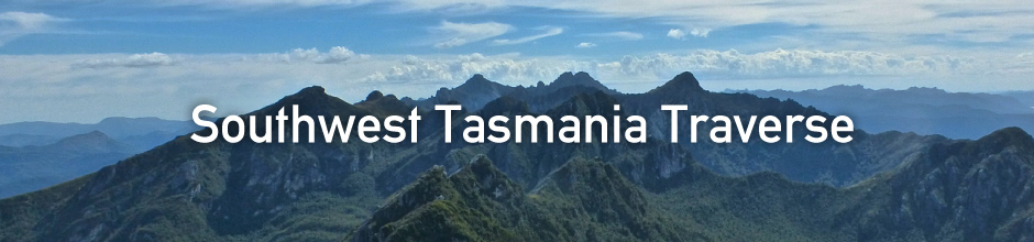
Cam “Swami” Honan: Southwest Tasmania Traverse


About Tasmania
Tasmania. Australia's southernmost state. The 26th largest island in the world.
Affectionately known by one and all as “ Tassie .”
Almost half of Tasmania’s total area is comprised of national parks, wilderness reserves and World Heritage Sites. It’s commonly regarded as Australia’s Hiking Mecca , though environmentally speaking, it’s actually more like the south island of New Zealand than it is mainland Australia (i.e. cool temperate climate, lots of rain, rugged mountains, very green).
In March of this year I completed a traverse of the southwestern region of the state. One of the wildest, most pristine wilderness areas on the planet, the trip took twenty four days to complete, and combined the rugged, trail-less coastline south of Strahan with the Arthur Range, arguably Australia's most spectacular mountain chain.


The first two weeks of the traverse were spent making my way down the remote
coastline south of Strahan. The terrain was a combination of rocky shoreline, pristine
beaches, buttongrass plains and dense bands of inland scrub.
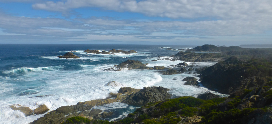
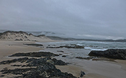
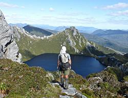
[Tassie's pristine western coastline.]
In more than a quarter of a century of hiking all around the world, this section represented some of the most challenging conditions I have encountered.
What made it so difficult?
Principally two things; bushwhacking and coastal gulches.
In regards to the former, there were a handful of days in which I hiked for twelve hours straight only to cover a grand total of five or six kilometres. The vegetation was incredibly dense, and fighting through it was an exercise in both patience and perseverance.

[During some of the thicker bushwhacks, occasionally I’d climb a tree to see what lay ahead……..usually it was more of the same!]
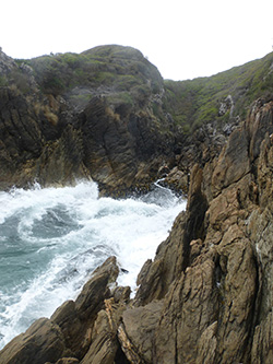
As for the gulches, they represented the most dangerous and technically difficult aspect of the entire hike.
Timing was key in negotiating these jagged and slippery ravines, which are regularly pounded by three to six metre high waves. Before attempting the more difficult gulches, I would often sit and watch the surf coming in for ten to fifteen minutes before I was satisfied that it was safe to go ( Note : waves come in sets).
The potential price of making an error in judgement, was getting smashed into the rocks and washed out into the Indian ocean.
Thankfully, the arduous bushwhacks & gulches, were broken up by some far easier stretches of beach walking.
Each and every time I’d emerge from the rocks or scrub onto a long expanse of golden sand, I’d break out into a big smile.
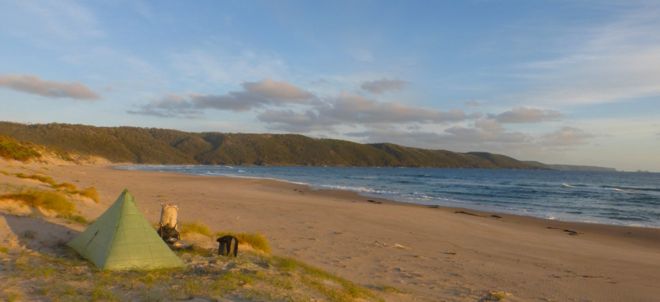
Partly because it was a welcome respite. But mostly due to the fact that the beaches were beautiful and there was not a footprint to be seen. A tangible reminder that it was just me, the coast and the ocean.

Indeed, during the first fourteen days of the traverse I only saw one person; a fisherman just north of Endeavour Bay on Day 5. For someone that has always enjoyed spending long periods of time by himself in nature, the solitude afforded by the Southwest wilderness was one of my favourite aspects of the trip.
After two weeks negotiating the rugged coastline, I finally headed inland for the final
time on the morning of day fifteen. It was a cold, rainy and foggy farewell.

The inclement conditions continued until late afternoon, when the weather finally broke and the sun reemerged.
The timing could not have been better, for I was just about to attempt what would be final significant challenge of stage one; a 150 metre wide crossing of the Davey River.
The waters of the Davey are both very cold and deep, and hypothermia was a distinct possibility. However, in planning the trip I decided against carrying a packraft or wetsuit, and instead opted to negotiate this and other long crossings on my inflatable sleeping mat. With my backpack floating behind tied off with a two metre piece of guyline, my system worked like a dream. Nonetheless, I was more than a little happy when I eventually reached the other side of the channel!
Almost two days after the crossing I made it to Scotts Peak Dam, the finishing point of the West Coast stage.
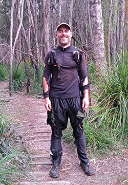
Before beginning the second part of my trip, I needed to pickup some supplies in the tiny town of Maydena (population 245). In order to do so I would have to hitchhike there and back. Which begged the question…………...would anyone give me a ride looking like this?
“No, Sir, I wasn’t mauled by a Bengal Tiger. I just finished hiking down Tasmania’s west coast.”
( Note : Jokes aside, the state of my clothing at the end of the West Coast section was an indication of the extremely dense and difficult terrain through which I was hiking. In no way was it a reflection of a lack of quality and/or durability of the items that I was wearing).

Despite my less than presentable appearance, I did manage to procure rides out and back to Maydena. The following morning (Day 19) I began the second stage of my journey, a six day crossing of the Arthur Range from Scotts Peak Dam to Farmhouse
Creek.
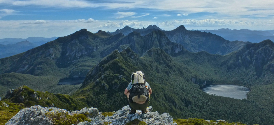
Arguably Australia’s most spectacular mountain chain, in fine weather the Arthurs is every hiker’s dream. Jagged quartzite peaks, hanging valleys, glacier carved lakes; stunning views from one end to the other.

[Arthur Range (photo by Viktor Posnov, whom I met during the second stage of the traverse).]
Unfortunately there’s a rather large caveat when it comes to backpacking in this area.
It’s called the “weather.”
Thanks in no small part to the Roaring Forties (i.e. galeforce westerly winds found in the Southern Hemisphere, generally between between 40° and 50° latitude) the Arthurs receive some of the most extreme conditions on the planet. The winds are often accompanied by horizontal rain and snow, and when coupled with the fact that much of the hiking is done on exposed rocky ridges, it is not a place you want to be without good backcountry skills and the right equipment.
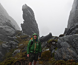
[During my 2015 Arthur Range Traverse, 85-90% of the hiking was done in driving wind and rain, accompanied by temperatures that hovered around freezing.]
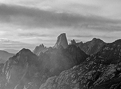
[Looking back at the Western Arthurs from Mt.Taurus.]
During two previous trips to the area, I had experienced more than my share of inclement conditions. In 2016 I was much more fortunate on the meteorological front.
Out of the six days it took to reach Farmhouse Creek, I encountered heavy rain and wind for only a day and a half. Not too bad for a place that averages 250 days of precipitation per year.
Despite the relatively mild conditions, hiking in the Arthurs is never easy. The vast majority of the track is either steeply up or precipitously down. Lots of scrambling, climbing, mud, roots and rocks. Indeed, if you are looking for a hike in which you can stretch out and cover big distances on a daily basis, it may be best to look elsewhere. In the Arthurs 0.5 to 1 kilometre per hour is usually considered to be very speedy progress!
[Descending to Lake Oberon]
One of the highlights of the second stage was a summiting of Federation Peak. A “holy grail” of sorts for many in the Australian hiking community, more than half the people that attempt the mountain are turned back due to foul weather.
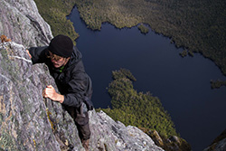
Fortunately on Day 22 the conditions were relatively fine and I managed to make a successful climb to the summit. I took the direct ascent route, which is a Grade 5ish scramble; not technically difficult, but extremely exposed. How exposed? I’m talking six hundred metres pretty much straight down to Lake Geeves……..definitely not for those with a fear of heights!
[The Direct Ascent Route / Lake Geeves below (photo Jason Macqueen )]
Upon reaching the top I broke out into a huge smile and let out an ebullient exclamation. I had the summit all to myself, and spent the next hour soaking in the amazing views. Eventually the clouds started rolling in and I knew that it was time to head back down.
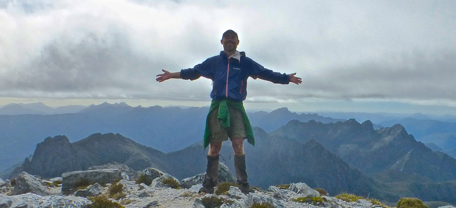
[Yours truly on the summit of Federation Peak.]

After Federation Peak, the final day and a half of the traverse was relatively uneventful.
I descended from the Arthur Range via Moss Ridge and the Bechervaise plateau. The “trail” was steep and more of a hand over foot scramble than a hike. Ducking and weaving my way through fallen trees and overgrown vegetation, I eventually bottomed out at Cherry Creek.
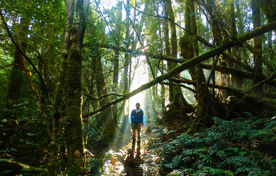
From that point on, the terrain was relatively flat and not so relatively muddy for the rest of the way. The highlight was some early morning sun rays piercing through the forest canopy just a few short kilometres from the end.
At 11 am on the twenty fourth day of my journey, I reached the Farmhouse Creek Trailhead. The finishing point of the Southwest Tasmania Traverse. The sun was shining. I broke out into a wee jig. What can I tell you; I’m half Irish!
I then put down my pack and went for a ten minute swim in the creek.
Soaking in the pleasantly warm water, I floated on my back and looked up at the pale blue sky. I thought about the last three and a half weeks. There was no way around it; there had been some very challenging moments.
Scrambling in out out of the wave smashed gulches, coming within centimetres of stepping on a Tiger snake and even a malfunctioning Personal Locator Beacon, which starting going off when it was inadvertently submerged in seawater on Day 5! I chuckled.
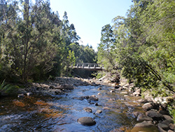
[Farmhouse Creek]
If truth be told, I’ve never been one for dwelling or second guessing. Stuff happens out in the wilderness, and my preferred method of dealing with it has always been to shrug my shoulders, learn from the experience and get on with things.
I think that’s one of the most important lessons I’ve derived from spending so much time in the woods over the past three decades. Not to overanalyse.
There are no “what ifs” in the natural world. Everything just is what it is.
And that very simplicity is a big part of what keeps drawing me back.
[Until next time | Leaving Farmhouse Creek Traihead – The End .]

Cam “Swami” Honan
One of the world’s most prolific hikers, Cam Honan has trekked more than 55,000 miles (88,514 km) in some 56 countries since the early 1990’s. In January, 2015, Backpacker Magazine called him, “the most travelled hiker on earth.”
>>>about CAM
Homepage: http://www.thehikinglife.com/
Facebook: https://www.facebook.com/thehikinglife
twitter:https://twitter.com/TheHikingLife
instagram:https://instagram.com/thehikinglife

● Thermawrap Jacket
My “go to” insulation layer for cold and wet environments since 2008.
● Peak Shell
The Peak Shell ticks all of my rain jacke t boxes. Lightweight, pit zips, semiathletic cut, durable, adjustable hood, quick drying and good DWR.
Since early 2015 I have worn this jacket in the Colombian Andes, Colorado Rockies and on two separate trips to southwest Tasmania. It has performed consistently well in the harshest of conditions.
● Versalite Pants
Lightweight waterproof pants that dry extremely quickly. I generally use the Versalite pants during the shoulder seasons, and go with the Montbell Dynamo wind pants during the warmer months of the year.
● Merino Wool Inner Gloves
Lightweight,breathable liner gloves that I often wear on their own in three season conditions or as a base layer during the winter.
● Chameece Beanie
Stretchy, comfortable, lightweight and just the right thickness for three season conditions.
● Super Merino Wool Highneck Shirt
Ideal for cooler climates. I prefer zip neck base layers, for greater flexibility over a wider range of temperatures and exertion levels.
● Tachyon Anorak
I am now on my third model. The first two both lasted at least 8,000 hiking miles (12,875 km) each. For an item that is so featherweight (1.9oz), the durability of the Anorak never ceases to amaze. I carry this jacket on virtually all of my backcountry trips, irrespective of the season.
-
U.L. Thermawrap Jacket Men's
Price: CHF199.00